In the past year, the water crisis in Flint, Michigan and the air quality emergency in Delhi, India have brought the inability of some cities to provide a healthy environment for their residents into sharper focus. However, as these crises unfolded, wealthy residents of these two cities were able to avoid or minimize their exposure by purchasing bottled water or relocating, even if temporarily.
Research has shown that land use policies – including those related to zoning, land tenure, provision of green space, transportation, and siting of hazardous materials – reinforce patterns of development that expose low-income urban residents to higher levels of pollution than high-income residents. As urban populations continue to grow over the next century, they will put even more pressure on the existing infrastructure systems already struggling to provide a healthy environment for urban dwellers. Understanding the nuances of land use policies can give managers more tools towards protecting public health.
However, much of this existing research focuses on a single city or a single pollutant. With this in mind, Data-Driven Yale is building on previous research to develop the first global spatially-explicit index integrating multiple environmental indicators to measure how environmental hazards and benefits are distributed throughout the city. The index will focus on five key environmental issues challenging urban sustainability – water and sanitation services, climate and energy, transportation, land use, and air quality – and compare levels of exposure to pollution among income groups.
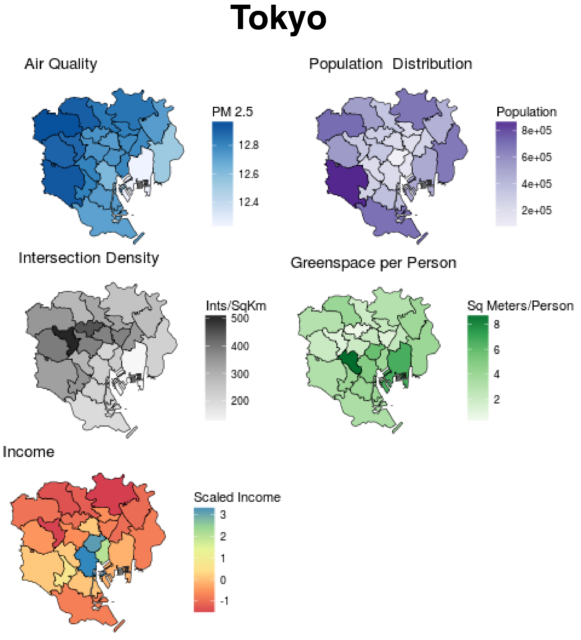
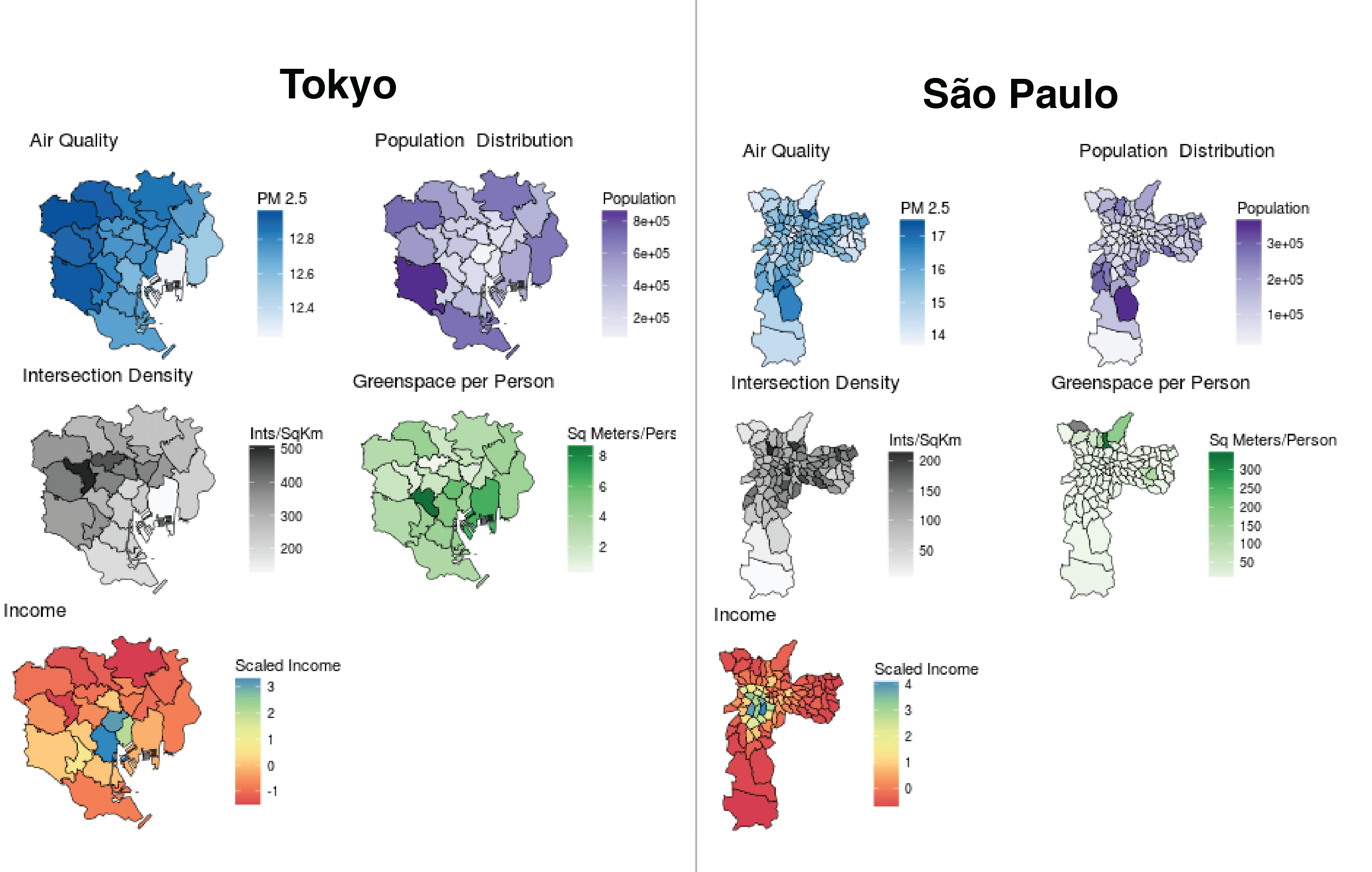
Map 1. Selected indicators from the urban environmental index for Tokyo.
Because people do not experience cities uniformly, we aim to incorporate as much spatial data as possible to examine differences, patterns, and trends in environmental performance at the neighborhood level. Using this approach, the new urban environmental index will allow comparison of neighborhoods within and between cities. For instance, are a city’s poorest neighborhoods also the areas most exposed to risks posed by climate change? Do low-income neighborhoods experience greater exposure to pollution than high-income neighborhoods in all cities? Are public transportation options accessible to all communities? This new research effort aims to answer these questions through a series of quantitative measures based on freely available data, accompanied by an online portal that will allow for interactivity.
We are actively seeking input on technical elements of the index, including data sources and development of indicators. If you are interested in serving as an expert contributor or reviewer, please email Ryan Thomas (ryan.thomas@yale.edu) by May 1 to receive our reviewer information packet or to join our upcoming webinar that will discuss and gather input on the index.
Recent Comments