
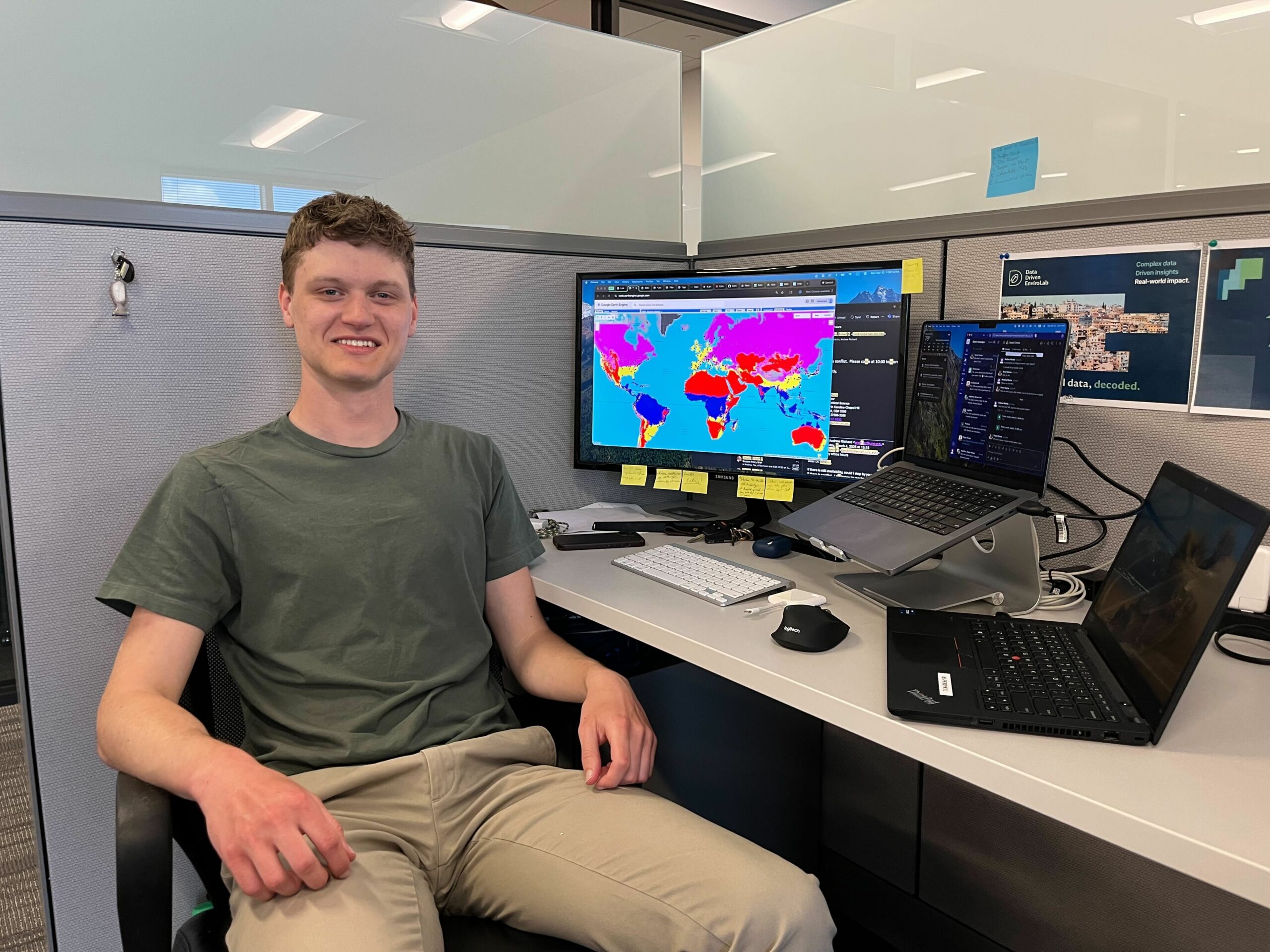
5 years ago, we released ClimActor, the largest harmonized global dataset of more than 10,000 subnational entities participating in climate policy networks like the Global Covenant of Mayors for Climate and Energy, C40 Cities for Climate Leadership, ICLEI Local Leaders for Sustainability, and more. Using ClimActor, researchers can track how subnational actors engage in climate networks, compare policy participation, and integrate the data with other environmental, political, or socioeconomic data. However, in the years since, the ClimActor policy network has expanded, and updates were needed.
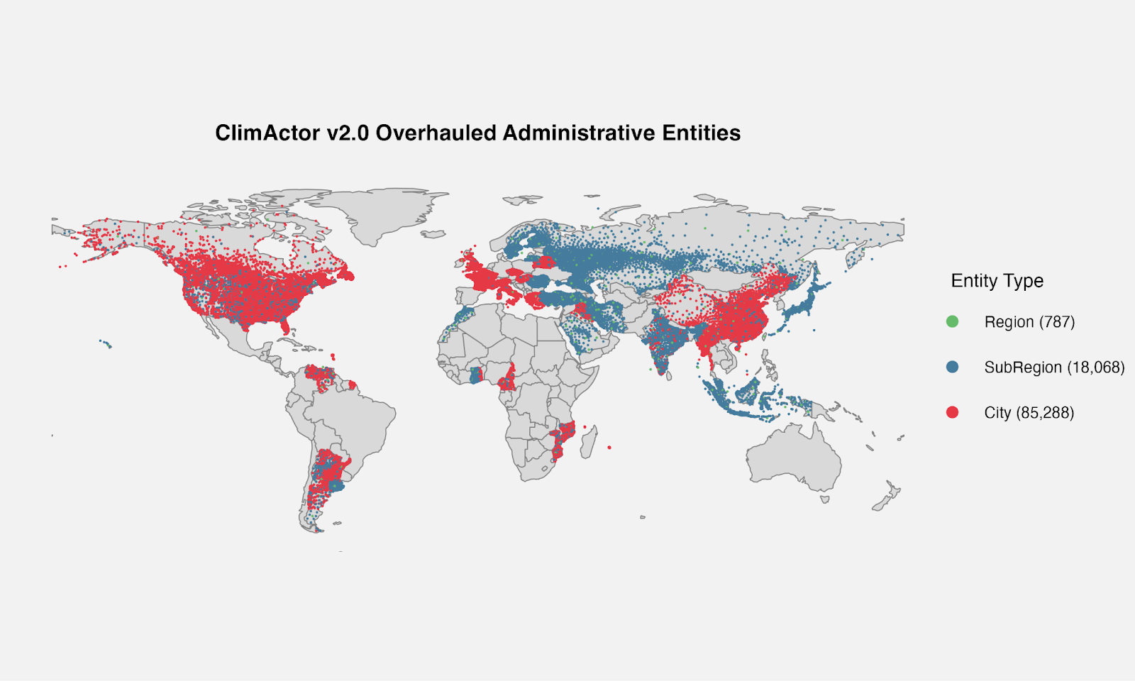
For this reason, ClimActor 2.0 is in the works! ClimActor v2.0 now includes a massive database of subnational government entities and geospatial information on each entity: estimates of area and population, its climate policies and pledges, and the locality’s situation in its country’s administrative hierarchy. This database forms the foundation for subnational climate policy data, since to answer relevant questions regarding who is pledging what actions and where, we often have to harmonize multiple secondary datasets. This dictionary database includes geographic data for each entry, so that the jurisdictions of each of these local governments can be mapped. It turns out that adding 119,000 entries to the total dictionary database, which now includes over 214,000 localities, is a puzzle of edge cases that don’t follow typical rules-based classification norms.
One would think that a quarter-million piece puzzle would have relatively few edge pieces compared to interior pieces. This puzzle didn’t seem like it: edge cases were everywhere: no two countries have identical administrative hierarchies, and no system is without its own quirks or exceptions. Here are some highlights I discovered as I embarked upon my summer journey of playing Carmen Sandiego for subnational climate policy data:
France
The first step in adding a country to the ClimActor dictionary is determining relevant pieces, such as:
- Which local governments have decision-making authority to build their own policy?
- Are there individual neighborhood councils, or is the smallest level more akin to a county?
- Is leadership elected or appointed?
- In between regional and local levels, are the divisions purely statistical (like census tracts or zip codes), or do they bear real authority?
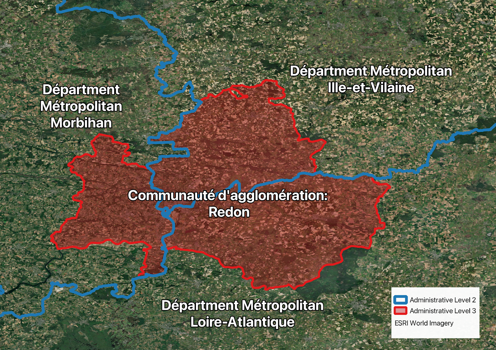
The French, famed for their tireless pursuit of bureaucratic elegance and practicality, are tied for the country with the most administrative levels with 5 hierarchical tiers of government (36,000 subnational entities!). This structure has unique variations in each of their overseas territories of Corsica, French Guyana, Mayotte, Martinique, Reunion, and Guadeloupe. Each territory has different names and structure for each level. On top of this complexity, not all administrative levels nest neatly into one another, resulting in a fascinating system of bureaucratic jenga. Third-level divisions, known as: Communauté d’agglomération, Communauté de communes, Communauté urbaine, Etablissement public territorial, or Métropole occasionally spill across into multiple second level divisions, known as Département d’outre-mer, Département métropolitain, Collectivité de Corse, or Département à statut particulier, and well, you get the idea.
Moldova
As part of ClimActor 2.0, each country’s territories are recorded in the dictionary using the UN recognized claimed (or disputed) territory. As such, because both Pakistan and India claim Jammu and Kashmir, the territories are included twice, once as part of India, and once as part of Pakistan. This redundancy ensures all localities are covered without diving into geopolitical dilemmas or starting territorial battles.
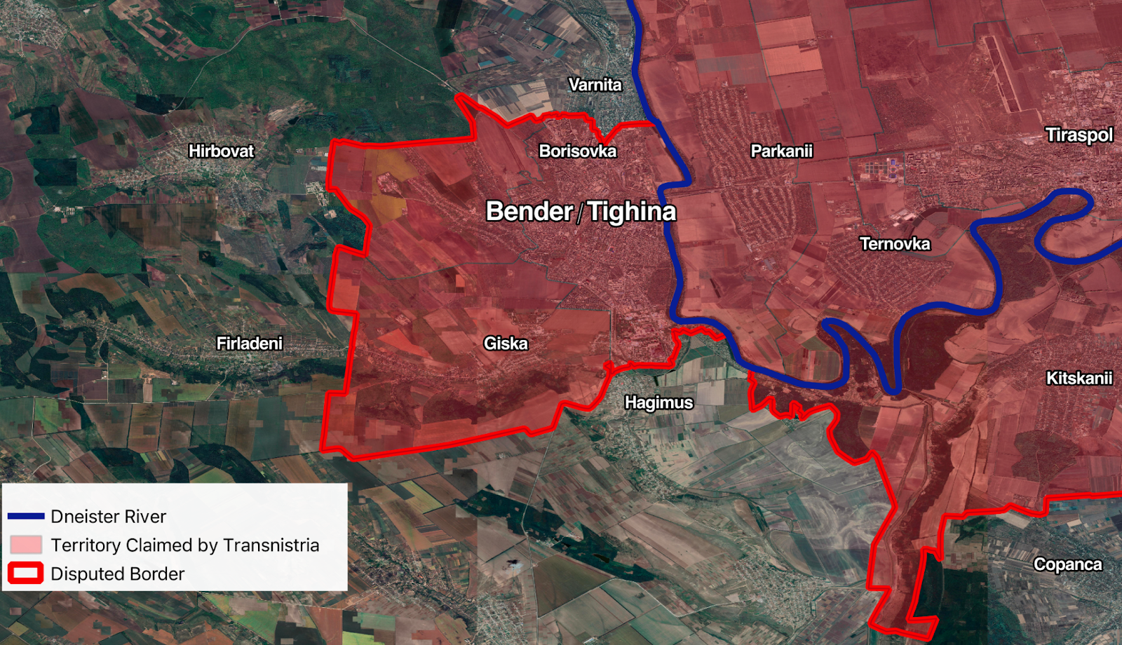
Within Moldova, a tiny former Soviet Republic the size of Maryland, the self-declared Pridnestrovian Moldavian Republic (Transnistria) claims to be a sovereign state. This stance would not be a particular problem, as they are not UN-recognized and therefore they are not included. That said, Transnistrian authorities certainly would not comply with Moldovan climate policy, and Transnistria has alternative names for many of its localities. One disputed border city is either called Bender or Tighina, depending on your affiliation to Moldova or Transnistria. The divergence in naming conventions introduces a data harmonization challenge, complicating the process of linking climate policies to the correct localities. Handling these cases (robustly enough to withstand the next generation of undergrad RAs) is awkward at best. In the end, the whole country was classified by Moldova’s standards, without the inclusion of alternate Transnistrian names. This could lead to blind spots if a climate policy only refers to a locality by its Transnistrian name, as only Moldovan names for localities are included in our database. That said, I highly doubt we will encounter Transnistrian policies anytime soon, given Transnistria’s total reliance on Russian fossil fuels, dependence on carbon-intensive steel exports, and addiction to corruption.
Greece
Greece’s administrative hierarchy is written into its Constitution, which you would think would make it simple. While this trend generally holds, I found exceptions.
Greece’s constitution exempts the semiautonomous region of “Autonomous Monastic State of the Holy Mountain” (Mount Athos) from the territorial hierarchy existing elsewhere in the country, and even exempts it from a fair bit of national and EU law. This anomaly emerges because the region of Mount Athos is inhabited solely by orthodox monks living in monasteries. Here, visitors are strictly limited, women are outright banned, and there is no formal government. Instead the patriarchs of the 20 monasteries form an informal council which meets as needed. That said, the monasteries don’t have formal geographic borders, making mapping these monastic “local governments” impossible. How do you handle a place that explicitly has no traditional bureaucracy or formal policy-making body?
In the end, Mount Athos is included as a distinct entity, but is the only first-level division of Greece without further local subdivisions. Consequently, I can confidently say that ClimActor is prepared should the monks of Mount Athos pledge to burn only incense, not fossil fuels.
Myanmar
Typically, we compile all decision-making subnational entities for ClimActor. One method for determining decision-making power is elections: if leaders are elected, they typically carry policy-making power and local agenda-setting power. On the other hand, if leaders are appointed, it is much more likely that they are to carry out the policy of their appointer, rather than the appointee making their own policy.
In Myanmar, elections technically exist, but in practice, all administrators above the village level are appointed by the 2021 coup-installed government. Only the fifth-level subdivision of individual villages has “elected leaders” where a village informally nominates a leader, who is then appointed by the fourth-level administrator. Additionally, since the coup Myanmar has balkanized into a patchwork of armed militias, revolutionary armies, and state-aligned factions, some of which have official autonomous regions (But all of which bear organizational resemblance to this skit from The Life of Brian). This raises two issues: First, how does a state like Myanmar, which has de jure but not de facto elections fit into our framework, particularly when only the hyper-local level (with the least capacity) has any kind of electoral legitimacy. Second, each one of the autonomous regions has a slightly differing administrative hierarchy, reminiscent of the aforementioned French bureaucracy jenga.
To navigate this challenge, we included administrative levels 1-4, as seen by the central government in Naypyitaw (which is itself a special administrative district and an exception to the structure), and adjusted our compiling individually for each of the autonomous zones. Ultimately, fifth-level administration data suffered from poor geographic data and sparse identifying attributes such as village names or ID code, so this level was wholly omitted.
Harmonization
After the full ClimActor dictionary of localities is built, then directories of subnational climate policies are assigned to the localities in the directory, which creates the final database of localities and their policies. For the most part, this is done programmatically, but what the code cannot handle is done manually. This manual matching was mostly identifying quirks of translation between scripts or spelling discrepancies. However, there were a couple notable moments.
In Romania, when a new village is founded, it seems the founders pick its name from a fixed list of about 50 options—the same standardized list given to every other village founder. This makes matching the climate policy of “Bucovăț” to the correct town difficult. The exceptions to this are the communes of “1 December” and “23 August” which I also thought were typos, but are actually named in memoriam of the 1918 revolution and overthrow of the fascist government in 1944.
When assigning a city known as “New York” to a locality in the ClimActor dictionary, I found the typical “State of New York”, “City of New York”, and even plain “York” but then ran into the Ukrainian town of Нью-Йорк (pronounced New-York). Upon further research, I found some notable headlines including: “Russian forces advanced into New-York as part of their efforts to seize a strategic ridge to the northeast,” which is a bit jarring to hear out loud.
When working though another large dataset of Ukrainian climate policies, I found myself struggling to find anything in the ClimActor dictionary entry resembling “Красноармійськ.” It turns out that since 2014, Ukraine has undergone a campaign to restore Soviet-renamed villages to their prior names. I then discovered that Красноармійськ roughly translates to “Red-Army-ville,” and I was able to properly assign the policy to its correct locality -already in the ClimActor dictionary- Покровськ (Pokrovsk).
Despite my sarcasm, I’m actually a big fan of the edge cases. They gave me an opportunity to dive into the local context and learn why Myanmar has so many autonomous regions or how the relationship between Moldova and Transnistria plays out in the day-to-day. After weeks of data processing, it can become easy to look at a map of localities and diminish them to names and coordinates, but the edge cases provide a window into how countries solve their bureaucratic issues (occasionally elegantly, often crudely) and navigate the relationship with their constituents.
As of October 21, Climactor 2.0 is released on GitHub! The preprint, ClimActor 2.0: A spatialized database of subnational climate pledges and emissions data, is officially archived at the UNC dataverse under DOI https://doi.org/10.15139/S3/GGWVVQ, further publication forthcoming.
